Saturday, July 30th, 2016 12:32 am
New Camera, Summer Heat and Bridge Closures
I have always been interested in photography, but I have never taken the time to learn anything about it. I had a Minolta 3xi film camera back in the day, but it mostly just sat around collecting dust. When I did use it, I was always on auto settings and I don’t think I ever learned how to adjust one parameter on that camera. In this age of digital photography, the best digital camera I have ever owned up until now is the one built in to my Lg G4 smart phone. So I decided, with all the trips I’ve been taking lately (and all of my unused music gear sitting around that I could sacrifice to offset the cost) that it was time to step my camera game up. I wanted something compact, with interchangeable lenses and excellent photo quality. Considering the fact that I am a complete novice, ease of use was a major priority and I did a ton of research; reading user reviews and forum posts about every camera I could find.
After a bit of searching, I narrowed down my choices to four cameras. The Canon Rebel t3i, Nikon D3300, Sony A6000, and the camera I ended up choosing, the Olympus OM-D E-M10.
 |
| My New Olympus OM-D E-M10 |
As far as specs go, I was happy with what every one of the cameras had to offer and as far as I could tell from searching online, photo quality was comparable. I decided to go with the Olympus because of its compact design, and the consistently positive reviews I was finding. I’m sure I would have been equally happy with whichever camera I chose, but I am really glad I chose the one I did. I have already learned a few basics that have improved my photography, and having a new camera has been a fun excuse to get on the road.
This week I had a three day weekend, which for me is Tuesday - Thursday and decided to take a solo trip around my local area on Tuesday, this time heading out to the east from Pittsburg along the Delta through Antioch, Oakley and Bethel Island. I wasn’t focused on finding a remote back road, but wanted to practice my photography. And so, on a 105 degree July day, I headed out, camera in hand to take some pictures.
I took Jersey Island Road, north from E. Cypress Road in Oakley. Jersey Island Road is a typical delta levee road, bordered by canals carrying water in from the San Joaquin River, and running through the vast acreage of a cattle ranch. I was going out that way to find a spot I saw on Google maps called Jackass point, but as I got farther down the road I started seeing signs about land use permits and decided to head back the other direction because I wasn’t sure if I was actually supposed to be there or not. This is not the first time I have turned back on one of these trips. A lot of the more remote roads out there run through regulated land, or even private property so I always try to be mindful of the boundaries and stay on public land. On the way back, I did stop on the side of the road to snap a few shots of some cows that were hanging out along the side of the road and an old oil derrick that had obviously been sitting motionless for a long time.
 |
| Some cows hanging out in the cool water on a hot day |

My next stop was Big Break Regional Shoreline in Oakley. Big Break is a small regional park with paved trails running back to the water and some pretty lush plant life. I stopped there during the hottest part of the day, and by the time I had walked about ¼ mile down the trail in the beating sun, I was feeling a bit over heated and in the 15 minutes or so that I was out in that sun, my shoulders got sunburned bright red. Needless to say, I didn’t stay at Big Break for long, I quickly retreated back to my truck and sat there with the A/C cranked contemplating whether or not I was going to keep going or head home. I decided to head for home but I took the route that kept me close to the river and stopped a few more times along the way.
 |
| Trying to catch a shot of some elusive otters |
After Big Break, I headed back to the west on Main Street and took Bridgehead Road up to the Antioch/Oakley Pier, at the base of the antioch bridge. Most people reading this that are from east Contra Costa County are familiar with this place and the pier is always extremely crowded and the fishing is terrible but the views of the bridge are pretty awesome and being on a local photography tour, it only made sense for me to stop there; I used to fish there every day before and after work, whatever hours I had available between 6:00 am and 10:00 pm. The Antioch Bridge is a 150-foot high, almost 2 mile long concrete girder bridge that spans the San Joaquin river and massive as it is, it dominates the skyline at the pier and makes for a pretty cool picture.
 |
| Antioch Bridge |
I continued on through Antioch, stopping at any spots where I could get some good shots without having to be out in the heat for more than a couple minutes at a time. I made one final quick stop at the Pittsburg Marina before heading home, but by that point the heat was getting to me and I was ready to get inside.
 |
| Antioch |
 |
| Antioch |
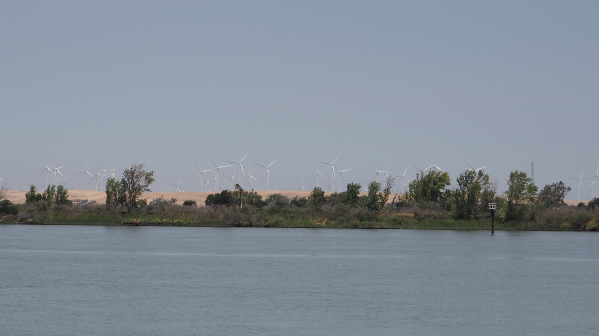 |
| Windmills |
 |
| Downtown Pittsbrug |
Thursday, Deena was supposed to be working, so I was going to cruise around town and practice with my new camera again. Just a few hours before she was supposed to start work, her boss called and told her she could have the day off if she wanted, so we immediately started trying to figure out a road trip we could take. My niece was in the hospital in Walnut Creek recovering from surgery, so we went over there to hang out with her for a couple hours and then stopped to grab some food before getting on the road. We still hadn’t figured out where we were going to go, but I had been wanting to check out the Isleton and Walnut Grove area so we started out north on 160 over the Antioch bridge and we were off. Just a couple miles down the road, traffic started slowing way down and all of a sudden we were at a standstill. They have been repairing and painting Three Mile Slough Bridge, which sits about halfway between the river and highway 12, for a few months now and it has been down to one lane. This Thursday they were finishing up and were cleaning up the last bit of mess left over on the closed lane of the bridge, and in place of the traffic light that was there previously were workers with stop signs, and they were not letting enough cars through each time, causing a major backup on both sides of the bridge. It took us almost an hour to move three miles and after sitting there on yet another 100+ degree day, I almost suggested that we turn around and figure out somewhere else to go, but we both agreed that we were in no hurry and continued on our way.
 |
| Deena taking in the view |
Tuesday, August 2nd, 2016
After that hour in traffic, staring at the back of a semi trailer, it felt nice to be moving again, and we were once again happy to be on the road. We made our way up highway 160, a.k.a River Road, heading toward Isleton, stopping briefly at a roadside turn off that ended up being nothing more than a dusty parking lot. Getting into Isleton, we crossed over Isleton Bridge, which is a rather narrow, steel deck drawbridge, typical of the California Delta region.
 |
| Isleton Bridge |
North about 15 minutes from Isleton is Walnut Grove, featuring yet another drawbridge very similar to the one in Isleton. We didn’t stop and look around much in Walnut grove we just drove through town and kept going north for several miles, just driving and trying to decide where the day’s journey would take us. We ended up choosing Jackson as our destination. Deena’s mom had spent time in Jackson and said she thought we would like it, so we’ve always wanted to check it out. The drive from the Walnut Grove to Jackson is a pretty straight shot across the expansive, Central Valley of California to Amador County. Two lane highways are flanked by endless miles of orchards, vineyards and pastures; Some parts of the central valley were much more beautiful than I had expected and it was a nice easy cruise. The weather in the valley was very unforgiving that day so we didn’t stop much until we got closer to Jackson. As we started up into the foothills, we were greeted by beautiful views of rolling hills. Large granite boulders dotted the landscape and seemed to be out of place amongst the trees and dry grass.
 |
| Amador County |
 |
| Amador County |
We didn’t hang out in Jackson for very long and continued on highway 88 out of town. We looped back around, heading towards highway 12, on highway 26. From the highway we spotted signs for the Mokelumne river and decided to stop and explore. The spot where we stopped is Big Bar launch area. The river forms rapids over and around large boulders, which have been polished smooth by the water barreling down the mountain and the water there is very cool and extremely clear. With a little more planning, a trip to the Mokelumne is going to be a guaranteed great time and we plan to go back sometime this fall when the weather is a little cooler. We continued on and headed straight back across the central valley and headed home. We were only gone for about 6 hours, but aside from the nightmare traffic on the way out of town, we had a great time.
 |
| Mokelumne River |
 |
| Mokelumne River |
 |
| Mokelumne River |
All in all, I really love the delta region and all the natural beauty (and bridges) it has to offer, and I now have a strong desire to continue exploring Amador County and the areas surrounding it. I have already been scouting a few new areas to check out, and with the help of my new (to me), Audubon Society field guide that a friend of mine just gave me today, I plan to explore more natural places and try to not go back to the same spots too many times.
Driving through all the dusty little towns along the back roads and two lane highways of northern California, is always a reminder to me that a simpler lifestyle is a real possibility if I believe I can make it happen and put in the work required to get there. Deena and I have a dream to own a small piece of land outside of small town somewhere, where we can be surrounded by the nature we are always seeking out. I am at a crossroads in life where I am conflicted about whether to thrust myself deeper into the corporate chaos that pays my bills, or to make a drastic change in life, and take the risks required to reap the greatest reward. I tend to favor the latter option, and the more trips I take; the more time I spend wandering, the more I know that the right thing to do is trust my instincts and make that move as soon as the option presents itself.
My name is Tim Drake.
This is my backroads blog.
-------------